Unique DTU space study on Artic icemelt

The inland ice sheet that covers Greenland is shrinking and the melting is happening faster. This is confirmed by a new, detailed study carried out by researchers in the Department of Geodesy and Earth Observation, led by senior researcher Sebastian Bjerregaard Simonsen. The new research was recently published in the journal Geophysical Research Letters.

Research shows that from 1992 to 2020, more than 4,400 Gigatons of ice melted away. This melted ice has contributed to a 12 mm increase in the water level of the world’s oceans.

The research is based on altitude measurements over the 28 years with the ESA satellites ERS-1, ERS-2, ENVISAT, CryoSat-2 and Sentinel-3A. The unique thing about a new study is that the satellites cover the entire period with an uninterrupted time series and are based on the same measurement methods year by year. The Danish research team is the first to translate the long European time series of height changes into mass loss.

“On average, this corresponds to 158 Gigatons of ice melting each year over this period of nearly three decades. But there are big differences during the period and a clear trend towards the melting accelerating,” says Sebastian Bjerregaard Simonsen.

In the 1990s, the average melting rate was 57 Gt ice/year. In the 2000s it was 163 Gt ice/year. And in the 2010s, the average was 241 Gt of ice/year.

Read more here or find the full article at:

Simonsen, S. B., Barletta, V. R., Colgan, W., & Sørensen, L. S. (2021). Greenland ice sheet mass balance (1992‐2020) from calibrated radar altimetry. Geophysical Research Letters, 48, e2020GL091216. https://doi.org/10.1029/2020GL091216

(Photo. Icebergs and large pieces of ice near Jakobshavn in Greenland. Photo: DTU Space/S.B. Simonsen)
How much meltwater is retained within the snow on the Greenland ice sheet?

We have just been involved in constraining the model range for firn model for the Greenland Ice sheet within the RETMIP project. The study was lead be GEUS and a summary of the findings is found below.

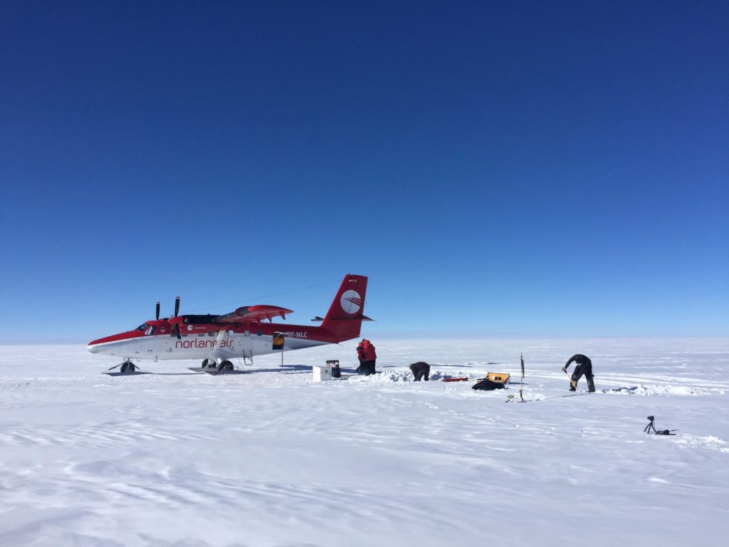
DTU Space conducting firn observations on the top of the Greenland Ice Sheet.

The thick snow that blankets the Greenland ice sheet provides a key service to the Earth’s system: the thick snow layer acts like a sponge when the surface of the ice sheet melts in the summer and prevents every year gigatons of meltwater to be poured into the ocean and contribute to sea-level rise. In a warming climate, we need computer models that can describe how this snow layer can retain meltwater generated at the surface of the ice sheet; and that is no easy task. Meltwater infiltrates and potentially refreezes in the snow depending on various parameters: the snow density and temperature, for example, or on how thick ice layers it contains. Multiple computer models are currently being used to simulate the retention of meltwater on the Greenland ice sheet. Yet, these models had never been evaluated on the same weather data input, until this new study.

A team of 23 researchers representing 18 research institutes and lead by Baptiste Vandecrux has evaluated nine snow models at four sites. These sites were chosen to represent the various climate present at the surface of the ice sheet: from cold and low-snowfall areas to warm and high-snowfall areas. What they found was striking: the snow models agree relatively well in the absence of melt, but the more melt was generated at the surface, the more models disagreed on where the water should infiltrate, whether it should refreeze and be retained or whether it should initiate a downslope flow towards the margin of the ice sheet and the ocean. Luckily, such a comparison exercise allows the team of researchers to identify key issues that snow models should address in the future. This greater insight on how snow models retain or not meltwater will hopefully allow the improvement of these models and allow a more accurate estimation of the current and future contribution of the Greenland ice sheet to sea-level rise.

The study was published in The Cryosphere and is available at : https://doi.org/10.5194/tc-14-3785-2020

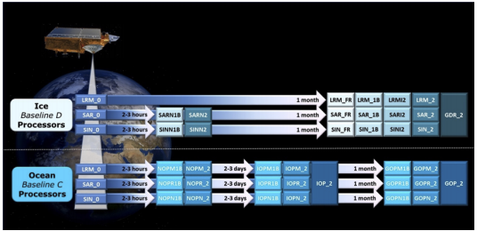
The new CryoSat-2 baseline D is now ready

The Baseline-D data products.

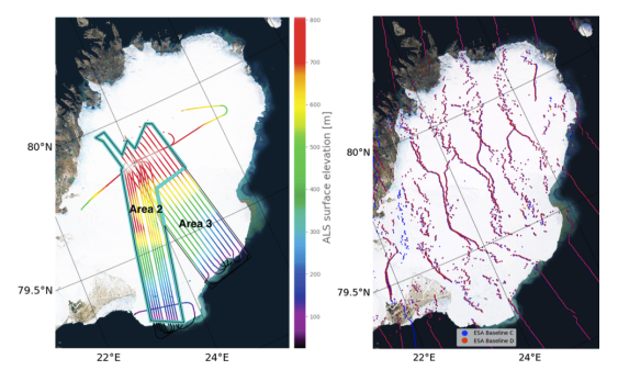
In connection to the development of the ESA Cryosat-2 baseline-D, we at EO4CRYO have been involved in the validation effort of the new product, based on our airborne surveys at Austfonna, Svalbard.

(left) The airborne elevation measurement from laser scanning. (Right) The differences in geolocation of the radar echo in the new and previous baselines.


How to cite and access the paper.
Meloni, M., Bouffard, J., Parrinello, T., Dawson, G., Garnier, F., Helm, V., Di Bella, A., Hendricks, S., Ricker, R., Webb, E., Wright, B., Nielsen, K., Lee, S., Passaro, M., Scagliola, M., Simonsen, S. B., Sandberg Sørensen, L., Brockley, D., Baker, S., Fleury, S., Bamber, J., Maestri, L., Skourup, H., Forsberg, R., and Mizzi, L.: CryoSat Ice Baseline-D validation and evolutions, The Cryosphere, 14, 1889–1907, https://doi.org/10.5194/tc-14-1889-2020, 2020.