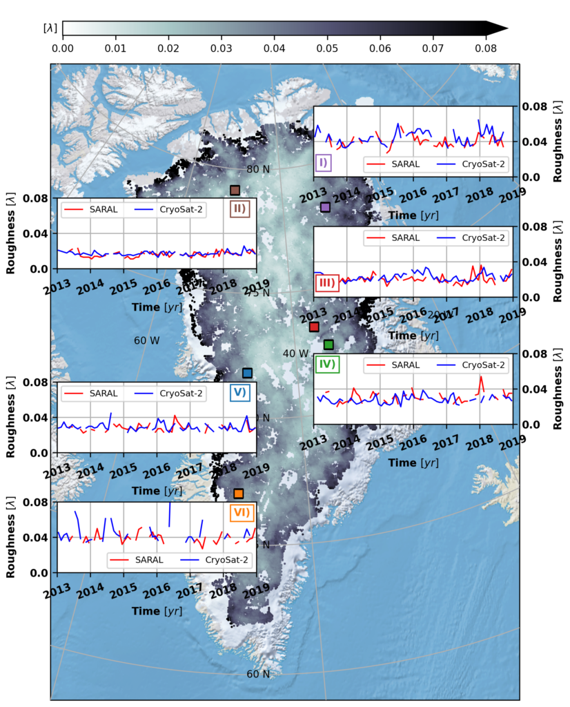
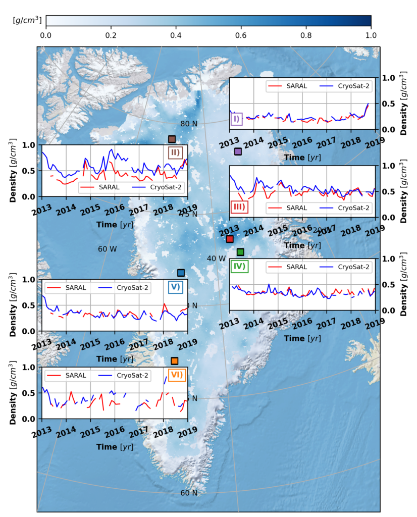
This new study investigates what other information we can extract from satellite radar altimetry measurements of the Greenland ice sheet in addition to changes in the surface elevation. Specifically, we want to know if the strength with which radar signals are reflected from the ice surface can be related to properties of that surface, namely its density and roughness; important things to know if we want to make accurate predictions of how Greenland will evolve with climate change. A useful analogy for how we approach this would be to think about how light from a flashlight reflects from different surfaces; a reflection from a mirror will look much brighter than a reflection from a carpet. It is similar type of analysis we apply to Greenland, only with different radar altimeters standing in as our flashlight.
The technique we use (Radar Statistical Reconnaissance) was initially developed to study the surface of Mars but has also been used to study Earth’s ice sheets as well as Saturn’s moon Titan. Through RSR, we can separate how “mirror”-like (i.e., coherent) the surface of Greenland is from how “carpet”-like (i.e., incoherent) it is. With a prediction of how radar energy reflects from a surface, we can then use the strength of the “mirror”- and “carpet”-like components to estimate the density and roughness.

Our timeseries and maps of density and roughness tell us how the surface of Greenland changed between January 2013 and December 2018. For the latter, surface roughness hasn’t changed so much with time, but seems tightly associated to ice flow speeds (i.e., where the ice flows faster, the surface is rougher). In terms of the former, density seems strongly affected by extremely warm summers (e.g., 2012 everywhere and 2015 in NW Greenland) before eventually returning to consistent levels. This result, and how it differs between our two different radar “flashlights” (ESA CryoSat-2, CNES/ISRO SARAL), leads us to think that we can, at least in a qualitative sense, measure how density changes with depth in the near-surface. Our CryoSat-2 “flashlight” seems to see a little deeper into the near-surface than SARAL, since CryoSat-2 densities are almost always greater, and the dense layers formed after summer melting take longer to be deeply buried by subsequent snowfall.
Overall, looking into how strongly radar signals are reflected from the surface of Greenland gives us new observations into how it responds in a changing climate. These observations are critical parameters in evaluating Greenland’s on-going contribution to global mean sea-level rise.

Full Study
Scanlan, K. M., Rutishauser, A., & Simonsen, S. B. (2023). Observing the near-surface properties of the Greenland ice sheet. Geophysical Research Letters, 50, e2022GL101702. https://doi. org/10.1029/2022GL101702
