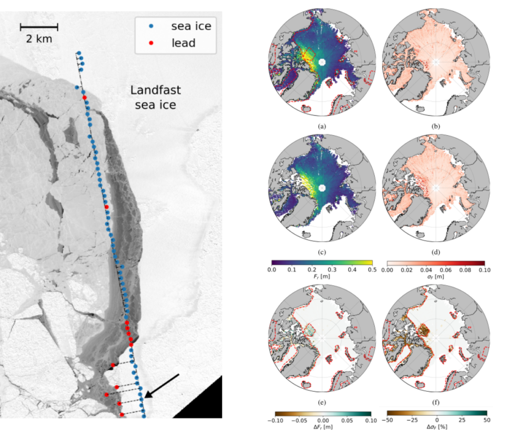
A new study by DTU Space and NASA JPL investigates the potential of performing “swath-like” processing of CryoSat-2 interferometric (SARIn) data over Arctic sea ice.
The proposed retracking method significantly increases the number of sea surface height retrievals, measured from leads, in the ice-covered Arctic Ocean reducing the uncertainty of sea ice thickness estimates from radar altimetry.

Right: sea ice freeboard and corresponding random uncertainty in March 2014 from the swath-like algorithm (a, b) and a processor not using the SARIn phase information (c, d). (e) is the difference (a)–(c), and (f) represents the percentage of variation of (b) with respect to (d). Red dashed lines represent the boundaries of the CryoSat-2 SARIn acquisition mask. Source: https://doi.org/10.1109/TGRS.2020.3022522
This technique might potentially be applied to data from the Copernicus Polar Ice and Snow Topography Altimeter (CRISTAL) mission, due to launch in 2027. While CryoSat-2 measures the sea ice in SARIn mode only along the Arctic coastline, the instrument onboard CRISTAL is planned to operate in SARIn mode over the entire ice-covered region, and this method could provide high-density sampling of the sea level and the sea ice thickness in both the Arctic and Southern oceans.
Full study:
Di Bella, Alessandro, Ronald Kwok, Thomas W. K. Armitage, Henriette Skourup, and Rene Forsberg. “Multi-Peak Retracking of CryoSat-2 SARIn Waveforms Over Arctic Sea Ice.” IEEE Transactions on Geoscience and Remote Sensing, 2020, 1–17. https://doi.org/10.1109/TGRS.2020.3022522.
